Heritage
Fish River Canyon: Visitor and Heritage Guide
A canyon 56 kilometers long and half a kilometer deep in southern Namibia, cut through rock older than almost anything else you can stand on.
- Country Namibia
- Category Heritage
- Reviewed 18 August 2026
- Sources 5
- Length 3 min read
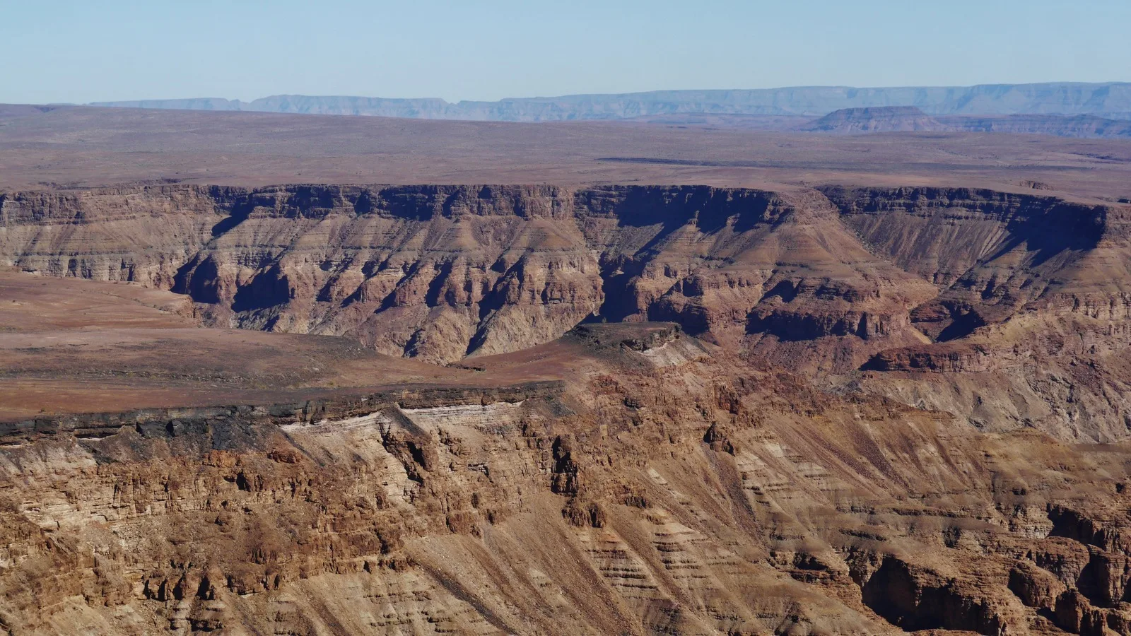
Credit Zairon, CC BY-SA 4.0, via Wikimedia Commons
Namibia’s other landscapes are made of sand and they are young. This one is cut into rock that was already ancient when the dunes were nothing, and the numbers in its nomination run to more than a thousand million years.
The name, and what was proposed
UNESCO files it as Fishriver Canyon, as one word. Everyone who goes there calls it the Fish River Canyon. Both are the same place, and the single word version is what you will need if you go looking for the record.
It was submitted on 3 October 2002 by the Namibia National Commission for UNESCO, as a natural property under criteria (vii), (viii) and (ix): natural beauty, earth history, and ecological process. More than twenty years later it is still on the tentative list.
The nomination describes it as the second largest canyon in the world after the Grand Canyon. That is a claim in the record rather than a settled fact, and comparable claims are made for canyons elsewhere. It is repeated here as what Namibia said, not as a ranking.
The measurements in the record
- 56 kilometers long, measured along the course of the river rather than in a straight line
- A lower, southern canyon 460 to 550 meters deep and about 5 kilometers wide
- An upper, northern canyon only 160 to 190 meters deep but about 8 kilometers wide
- A proto canyon whose floor sits about 300 meters above the river today
- The hot spring at Ai-Ais at about 60 degrees Celsius, and a sulfur spring upstream at about 56
How it was made, which is the reason for criterion (viii)
An earlier canyon existed here as long as 300 million years ago, floored by sandstone and black limestone of the Kuibis Subgroup of the Nama Group, and it filled with sediment at the end of the Dwyka glaciation. Erosion then worked sideways rather than down, and flattened the Huns Plateau.
What changed everything was the break up of Gondwana about 130 million years ago. The continent lifted, and the river started cutting downward instead. UNESCO notes that the sheer number of meanders shows the river had been running slowly across a very even surface before that: the bends were inherited from a lazy river and then sawn vertically into rock.
It cut first through the flat Kuibis layers, then reached the gneisses, amphibolites and migmatites of the Namaqualand Complex beneath, which had been metamorphosed about 1,200 million years ago. Dark diabase dykes about 770 million years old cut across those. The contact between the two is visible, and the rocks on either side of it erode in visibly different ways.
A canyon that is also a fault system
The upper canyon is a tectonic trough, bounded by a sharp fold on its western side and a straight reverse fault on its east. Steeply tilted faults bound the lower canyon too, and the record notes that several of them can be seen from the main lookout point.
Those faults cut Karoo Sequence rocks, which makes them younger than 300 million years. And they are not all the kind you would expect: the canyon formed in a rift valley, where the crust is pulling apart, yet some of the faults record compression instead. Groundwater uses those fractures to reach the surface, which is where the hot springs come from.
Visiting, and one thing to take seriously
The viewpoints on the eastern rim are reached by road and are where most visitors see the canyon. The multi-day hike along the canyon floor is a different proposition entirely: it is seasonal, controlled, and physically demanding, and people have died on it.
Permit rules, opening seasons, medical requirements and party size limits for the hike are set by the Namibian authorities and change. None of them is stated here, because none was read from a current authority. The Ministry of Environment, Forestry and Tourism and the Namibia Tourism Board are the places to confirm them, and they are linked below.
Southern Namibia is hot, exposed and thinly serviced. The FCDO advice on driving and on remote travel applies here as much as anywhere in the country.
Before you go
- Confirm the hiking season, permits and medical certificate requirements with the authorities, not with a blog
- Rim viewpoints are accessible by road; the canyon floor is not a casual walk
- Carry far more water than seems reasonable, and start early
- There is no phone coverage in most of the canyon, so tell someone your plan
- Gravel road driving is the leading cause of serious injury to visitors in Namibia, and speed is the reason
Sources
- UNESCO World Heritage Centre: Fishriver Canyon, tentative list ref 1745
- UNESCO World Heritage Centre: World Heritage and tentative list properties in Namibia
- Namibian Ministry of Environment, Forestry and Tourism: the national authority for parks and conservancies
- Namibia Tourism Board: the national tourism authority
- UK Foreign, Commonwealth and Development Office: Namibia travel advice
The dimensions, geology, dates and spring temperatures on this page are read from the UNESCO tentative list record of 2002. No permit rules, fees or seasons are stated here, because those change and none was read from a current authority.