Heritage
Okavango Delta: Visitor and Heritage Guide
A river that never reaches the sea, flooding a desert in the middle of the dry season, is the whole reason the Okavango exists.
- Country Botswana
- Category Heritage
- Reviewed 18 August 2026
- Sources 3
- Length 2 min read
Credit Diego Delso, CC BY-SA 4.0, via Wikimedia Commons
The Okavango is easy to describe badly. It is not a swamp, it is not an oasis, and it is not a river delta in the sense that word usually means, because a delta normally meets the sea. This one meets the Kalahari and stops.
What is inscribed, and what it is
The Okavango Delta was inscribed on the World Heritage List in 2014, in the natural category. The inscribed property covers 2,023,590 hectares with a buffer zone of 2,286,630 more.
It is an endorheic delta: one with no outlet to the sea, whose waters drain instead into the desert sands of the Kalahari Basin. UNESCO records it as Africa’s third largest alluvial fan and the continent’s largest endorheic delta, with permanent swamps covering some 600,000 hectares and up to 1.2 million more of seasonally flooded grassland.
The flood arrives in the dry season
This is the fact the whole place turns on. The Okavango River, 1,500 kilometers long and the third largest in southern Africa, rises in Angola. Its flood takes months to reach Botswana and arrives at the peak of the Botswanan dry winter, around June and July.
UNESCO’s citation describes the result as the miraculous transformation of huge sandy, dry and brown depressions by winter season floods. The plants and animals have synchronized their growth and reproduction to water that falls as rain in another country in another season. That is the interaction of climate, hydrology and biology the inscription is actually about.
The geology behind it is the African Rift Valley System, which captured the river and spread it out. The delta sits in a tectonic trough.
Seeing it
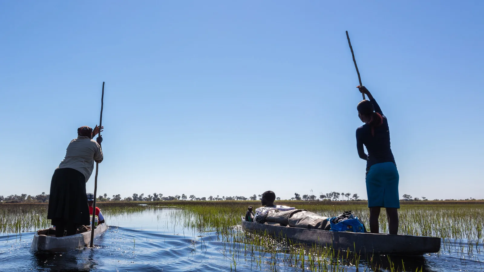
The mokoro, a shallow dugout poled from the stern, is how the channels have always been traveled and it remains the best way to see the delta at water level. It is quiet, which is the point. Motorboats cover deeper water and more distance. Light aircraft transfers give you the shape of the thing, which no photograph really does.
The delta is home to species UNESCO lists as among the world’s most endangered large mammals, including cheetah, both white and black rhinoceros, African wild dog and lion. Access is deliberately limited and the camps are small, which is why it is expensive and why it is empty.
One instruction that is not optional
Do not bathe in the water. The travel advisories say so for the whole country and they mean it here in particular: crocodile and hippopotamus are present throughout, and schistosomiasis is among the named health risks. A guide who tells you where you may put your feet is not being cautious.
Understanding the delta
- The flood peaks around June and July, in the middle of the dry season
- The water is Angolan rain from months earlier
- It is endorheic, so the river never reaches the sea
- A mokoro shows you the channels, a light aircraft shows you the shape
- Never enter the water, anywhere, for any reason
Sources
- UNESCO World Heritage Centre: the Okavango Delta, inscription 1432
- UNESCO World Heritage Centre: Botswana, its inscribed properties and its Tentative List
- UK FCDO: Botswana safety and security
The areas, distances and descriptions above are taken from the World Heritage Centre’s record of the inscription.