Heritage
Rainforests of the Atsinanana: Visitor and Heritage Guide
Six rainforest parks along the eastern escarpment, inscribed in 2007, on the Danger List for fifteen years and removed from it in 2025.
- Country Madagascar
- Category Heritage
- Reviewed 19 August 2026
- Sources 3
- Length 2 min read
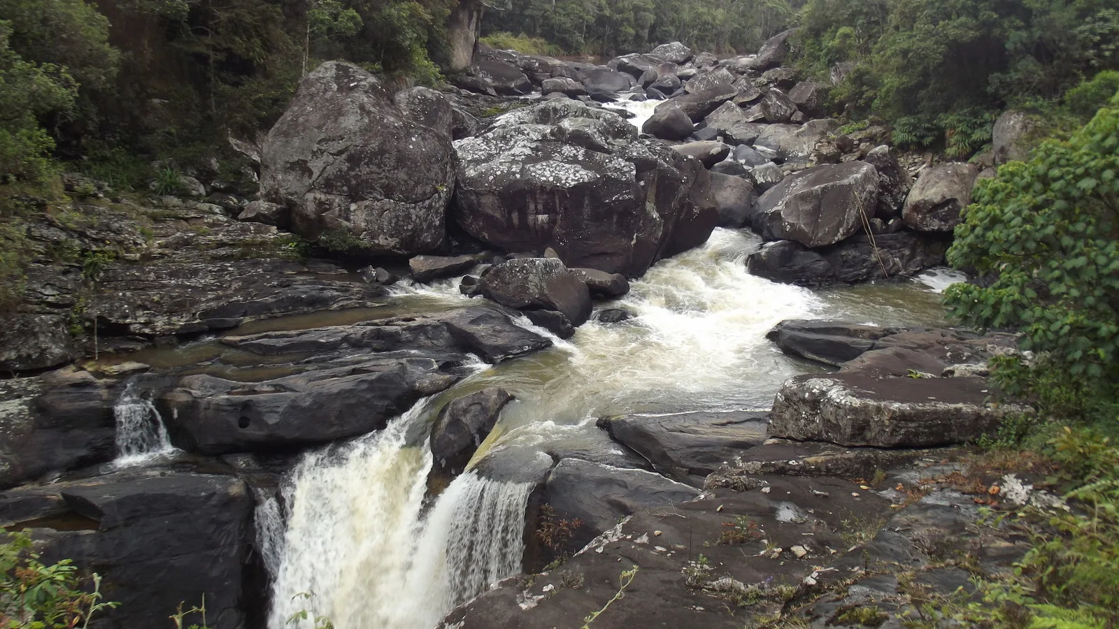
Credit Smiley.toerist, CC BY-SA 4.0, via Wikimedia Commons
The Rainforests of the Atsinanana are a serial natural property of six components strung along the eastern escarpment of Madagascar, inscribed in 2007 under criteria nine and ten over 479,660.7 hectares. The six are Marojejy, Masoala, Zahamena, Ranomafana, Andringitra and Andohahela, and all six are national parks with management plans in place.
The inscription is about process as much as about species: these forests are where the island's biota, isolated for tens of millions of years, can still be seen doing what isolation does.
Fifteen years on the Danger List
The property was placed on the List of World Heritage in Danger in 2010, after illegal logging of rosewood and ebony and a wave of lemur hunting that followed a period of political crisis. It stayed there for fifteen years.
It was removed in 2025, alongside two other African properties, following sustained work on enforcement and management. That is a genuinely good piece of news and it is rare enough to be worth stating plainly: the Rainforests of the Atsinanana are no longer on the Danger List. Anything you read describing them as currently endangered predates that decision.
Which one you are actually visiting
Ranomafana is the component most visitors reach, and it is the one in the photograph above: montane rainforest in the southeast, the Namorona river running through it, and a research station that has been working there for decades. Andringitra and Andohahela are in the south, Zahamena in the center east, Marojejy and Masoala in the far northeast, the last of them the largest and hardest to get to.
The thing to be clear about is what is not on the list. Andasibe-Mantadia, which is the rainforest nearly every Madagascar itinerary includes because it is three hours from the capital, is not one of the six components. It has its own page in this cluster and its own reasons to go.
If you go
- Choose a component and plan around it. They are far apart.
- A licensed guide is required at every park and is included in the fee.
- The night walks are the point. Bring a proper head torch.
- It rains in every month on this side of the island. Bring the jacket.
- Trails are steep, rooty and slippery. Boots with ankle support.
- Leeches are common and harmless. Repellent helps a little.
Why the forests matter to this site
Madagascar separated from the rest of Gondwana long enough ago that most of what lives here lives nowhere else, and the eastern rainforest is where the highest proportion of it survives. The band is also narrow, broken and shrinking, which is what put the property on the Danger List in the first place and is why the removal is a beginning rather than a conclusion.
Sources
- UNESCO World Heritage Centre: Rainforests of the Atsinanana
- UNESCO World Heritage Centre: Madagascar
- Madagascar destination guide
The inscription year, criteria, area, the six named components and the Danger List dates were read from the UNESCO World Heritage Centre page for the Rainforests of the Atsinanana and its maps page on 19 August 2026. The property was on the List of World Heritage in Danger from 2010 and was removed on 9 July 2025.