Heritage
Ngorongoro Conservation Area: Visitor and Heritage Guide
A caldera, a hominin record four million years deep, and a property inscribed for both, with five criteria and a Danger List decade.
- Country Tanzania
- Category Heritage
- Reviewed 19 August 2026
- Sources 4
- Length 2 min read
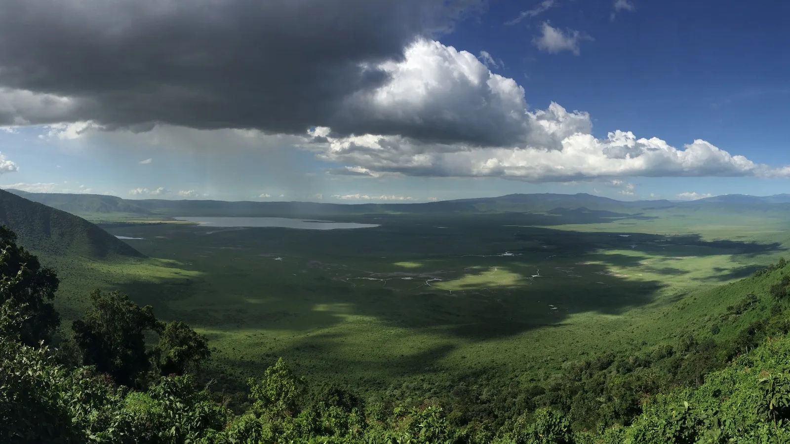
Credit PLBechly, CC BY-SA 4.0, via Wikimedia Commons
Before this page goes any further: this publication already carries a signed essay on Ngorongoro by Alex William Machage, a Tanzanian tour operator and historian, and it is the better piece of writing on what this place means. It is linked at the foot of this page and you should read it.
What follows is the narrower thing: the inscription, what is on the ground, and what the record shows.
The only property here inscribed for both nature and human history
The Ngorongoro Conservation Area covers 809,440 hectares and was inscribed in 1979, with its boundaries significantly modified in 2010. It holds five criteria, (iv)(vii)(viii)(ix)(x), which is more than any other Tanzanian property and is why it is classed as mixed rather than natural or cultural.
It was established in 1959 as a multiple land use area, with wildlife coexisting with semi-nomadic Maasai pastoralists practicing traditional livestock grazing. That arrangement is the defining fact about the place and it is written into the inscription rather than being incidental to it.
The crater, and the gorge
The property includes the Ngorongoro Crater, the world's largest caldera, and Olduvai Gorge, a 14 km long deep ravine. It runs from the plains of the Serengeti in the north west to the eastern arm of the Great Rift Valley.
The archaeological record is what criterion (iv) is for. The area has been excavated for over eighty years and has produced evidence spanning almost four million years: the fossilised footprints at Laetoli, associated with the development of human bipedalism and dated to some 3.6 million years; a sequence of hominin species in Olduvai from australopiths through Homo habilis and Homo erectus to Homo sapiens; an early form of Homo sapiens at Lake Ndutu; and, in the crater itself, remains documenting stone technology and the transition to iron.
The Danger years, 1984 to 1989
Ngorongoro was placed on the List of World Heritage in Danger in 1984 and removed in 1989.
It is worth knowing because it is the earliest of three such episodes among Tanzania's properties and because it ended. A Danger listing is not a verdict on a place; it is a request for help and, in this case, one that worked.
Practical notes
- The crater rim sits high and is genuinely cold at night, which surprises people who packed for the equator.
- Descent into the crater is controlled and timed, and is arranged through your operator.
- Olduvai and Laetoli are part of the same inscribed property, not a separate excursion to somewhere else.
- The area is a multiple land use area, so people live and graze here. Ask before photographing anyone.
- The managing authority's own website was unreachable when this page was written, so plan through your operator.
- Read Machage on this place before you go.
Sources and references
- UNESCO World Heritage Centre: Ngorongoro Conservation Area
- UNESCO World Heritage Centre: United Republic of Tanzania
- Ngorongoro Conservation Area: a history between human, heritage and wildlife
- Tanzania: a land that echoes with rich and diverse history and heritage
All figures, dates, criteria and the Danger List years are from the UNESCO inscription for the property, read on 19 August 2026. The Ngorongoro Conservation Area Authority's own site could not be read: it returns a redirect loop in a browser.